

East White Hills Military Site
East White Hills, St. John's
Located in the East End of St. John's, White Hills is an area that played an important role during both World Wars. It was the site where the Newfoundland regiment trained for battle in the early years of the first world war. This training exercises were known as "Skirmishing Expeditions". During this training soldiers would learn survival techniques that would later help them on the battlefields of Europe.

In 1941 under the Lend-Lease Agreement the United States obtained 198 acres on the north side of Quidi Vidi lake to build a military base named Fort Pepperell. They also obtained 2.5 acres on St. John's Harbour for a supply dock, 2.5 acres for an Anti-Aircraft Battery on Signal Hill, and 27.57 acres in the White Hills area for a radio tower. The radio tower at White Hills was completed in January of 1942 and in 1943 the Americans gained an additional 860 acres to be used as a target range on White Hills. During this time a number of bunkers, roads, buildings, and a large rifle-range were built in the area. Between 1941 and 1944 large training exercises were done here to prepare soldiers heading over seas for the harsh winter condition in Europe.
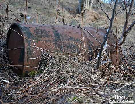
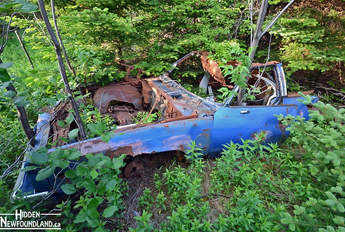
The Americans left the area in 1961. After they left it was discovered that in order to minimize the amount of equipment they would need to send back to the United States, they dug a large hole in the ground and dumped many of their old vehicles, 45 gallon oil drums, scrap metal, etc. into it. The hole was then buried over with soil. Oil and dangerous chemicals quickly leached into the soil and greatly contaminated the areas surrounding soils and water table.
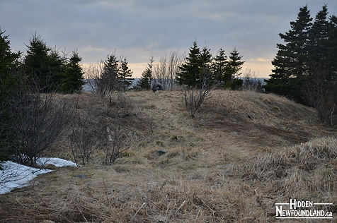
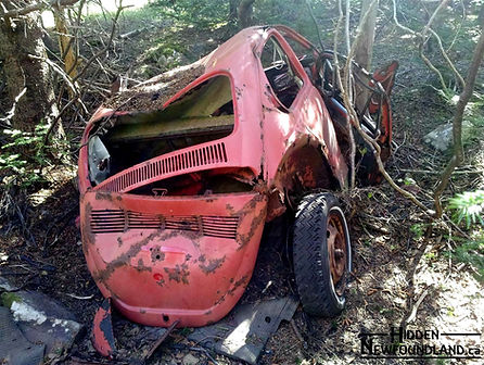
Today White Hills is a popular spot for hikers, mountain bikers, and ATV enthusiast. Many old roads and hiking trails give excellent access to the area. The area the Americans occupied in White Hills was enormous. Many of the bunkers, buildings, foundations, cars and other pieces of history are scattered over the area lost in the alders and tall grass. Its a great place for hiking and exploring because there is always something new to find.
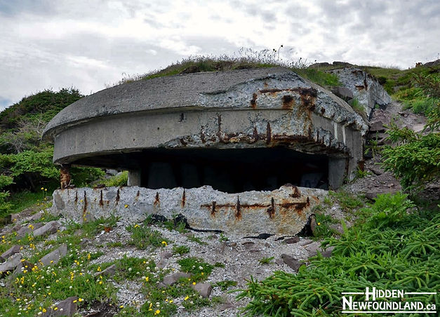
Bunker Hill
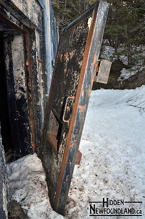
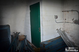
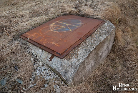
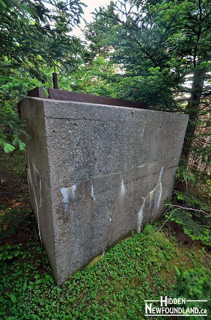
One of the most significant things to find in White Hills are the underground storage bunkers left in the area. Most of the bunkers lie alongside some of the old roads around the area and all are relatively clustered close to the Dept. of Fisheries and Oceans buildings. Many of these bunkers are locked up and used by private companies for things such as chemical storage.
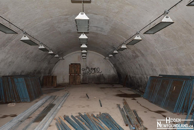
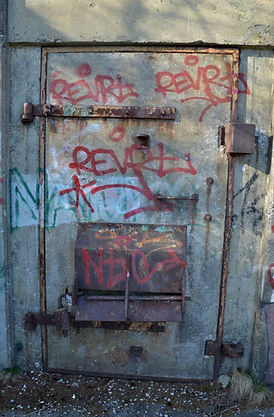
The bunkers here were known as ammunition "igloos". These ammunition igloos were built with 18 inch thick, concrete walls and were covered with soil, grass and trees so they would avoid aircraft detection. 12 of these bunkers were built here however only five remain easily found. Several forums I have read including a local urban exploring page, Forgotten Newfoundland say that there are six remaining but I have yet to find the 6th.
However there are quite a few with the doors unlocked or left open and able to be explored.
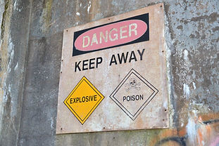
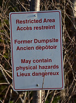
The Former Dump Site
The former dump site today is now recognized for the dangers it possesses. Signs warn of contaminated soils and the dangers of walking in the area. The dumpsite appears to be an ordinary empty field with a small pond at its eastern end. With closer examination you can see rainbow coloured streams and puddles caused by oil. Oil drums, jeeps chassis's and old wood and scraps of metal can be seen now poking out of the grass in the area.

With new housing and commercial expansion in the Pleasantville area happening the provincial and municipal governments have been pushing the federal government to do a clean up of the area, but no agreement has been made yet. For more information on this click here.

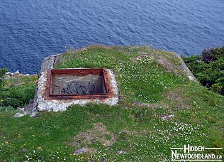
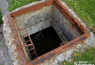
Underground Fuel Tank
Just off East White Hills Road is a road that takes you to the RCMP headquarters. Just off this road is a gated off dirt road. This road leads to a magnetic field observatory owned by the federal government. If you walk to the top of the hill here you'll come to a fork in the road. Just off the left side is an underground, camouflaged 50,000 gallon fuel tank. The only way you would know it is there is by noticing a ventilation pipe coming out of the roof of the tank.
Radio Tower Structure and the St. John's Harbour Anti-Torpedo Nets
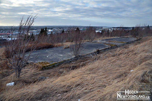
At the top of the Magnetic Field Observatory's dirt road is a fork where you can continue straight and go up and around a sharp left hand corner and meet another locked gate, OR you can make an immediate left and head down a long straight, partially grown in path. At the end of this path near the edge of Concrete Ltd's quarry, are the remains of several large support pillars and a concrete foundation. I believe this is the remains of the old military Radio Tower and its Operations building.
However located next to these supports is something much more interesting. What is left of the St. John's harbour anti-torpedo nets now lie in a large pile next to these pillars. Three sets of these once spanned across the narrows to protect the harbour from enemy U-Boats. In March 1941 they proved useful when they stopped a U-Boat torpedo from entering the harbour and striking a ship.
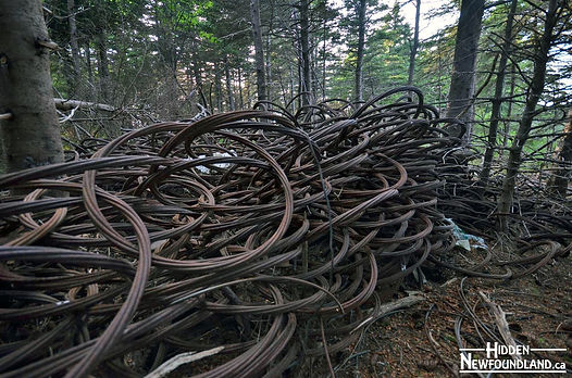
In 2010 the Telegram did an article on these forgotten defenses and described the concerns that people had about letting such an important part of St. John's history rust away and not be preserved. Find the article here.
Robin Hood Bay Battery
This was one of several batteries placed along the east coast during World War 2. The men working here were in charge of spotting enemy U-boats and was very similar to the one located at Red Cliff.
While reading up on White Hills, I read some peoples comments who claim that there is a tank located in the area somewhere possibly near the shore on Robin Hood Bay. I read that a military tank was brought in for training purposes but assumed it would have been removed when Pepperell was decommissioned. However many people believe it to remain somewhere on the site.
Sources & Further Exploring
Cardoulis, J. (1990). A Friendly Invasion: The American Military in Newfoundland, 1940-1990. St. John's, N.L.: Breakwater.
Fort Pepperrell, St. John's. Newfoundland and Labrador Heritage website found at www.heritage.nf.ca/articles/politics/pepperrell-base.php
Newfoundland and Labrador Studies, 22 (2). Retrieved through the Centre for Newfoundland Studies.
O’Brien, M. (2007). Out of a Clear Sky: The Mobilization of the Newfoundland Regiment, 1914-1915.